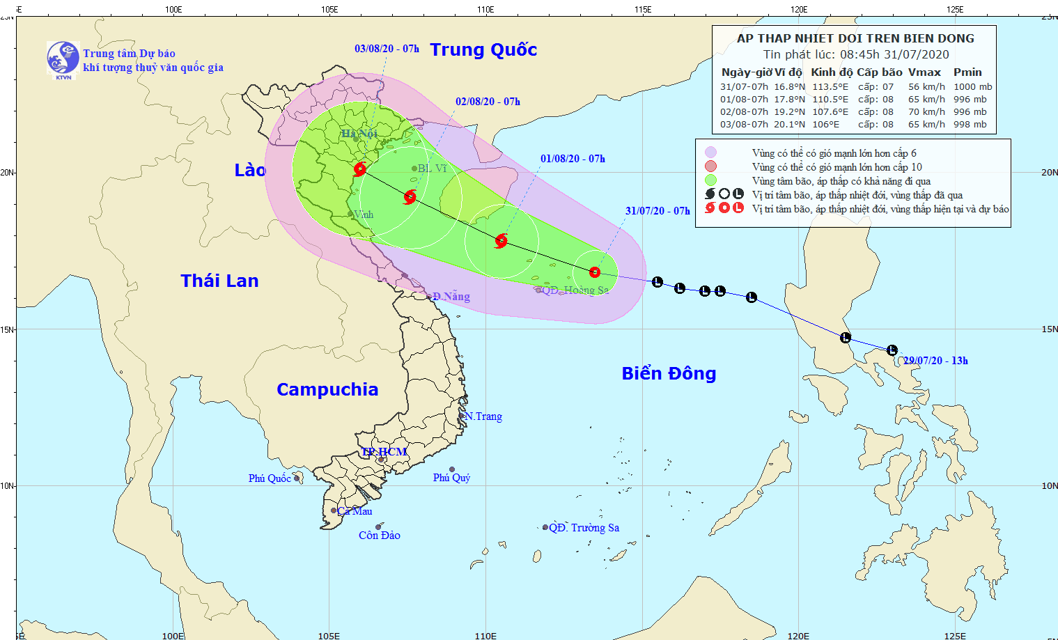
At 7AM of July 31, the system was located at around 160 kilometers from the eastern part of the Paracel Islands with a maximum wind of 40 to 60 kilometer an hour near its center.
Within the next 24 hours, the tropical depression is likely to move the west- northwestward and turn into a storm.
Tomorrow, the tropical storm will be at around 100 kilometers from the eastern territorial water of the Hainan Island Province (China) with its maximum speed of up to 60-75 kilometers per hour.
The storm will result in rain, thunderstorm spells, big waves of 2 to 5meters and rough sea across the Paracel and Spratly Islands, territorial waters from Binh Thuan to Ca Mau including Phu Quy Island District.
In the next 48-72 hours, the dangerous system is able to move the west- northwestward at a speed of 10 kilometers an hour and make landfall in the Northern and North- Central regions.


