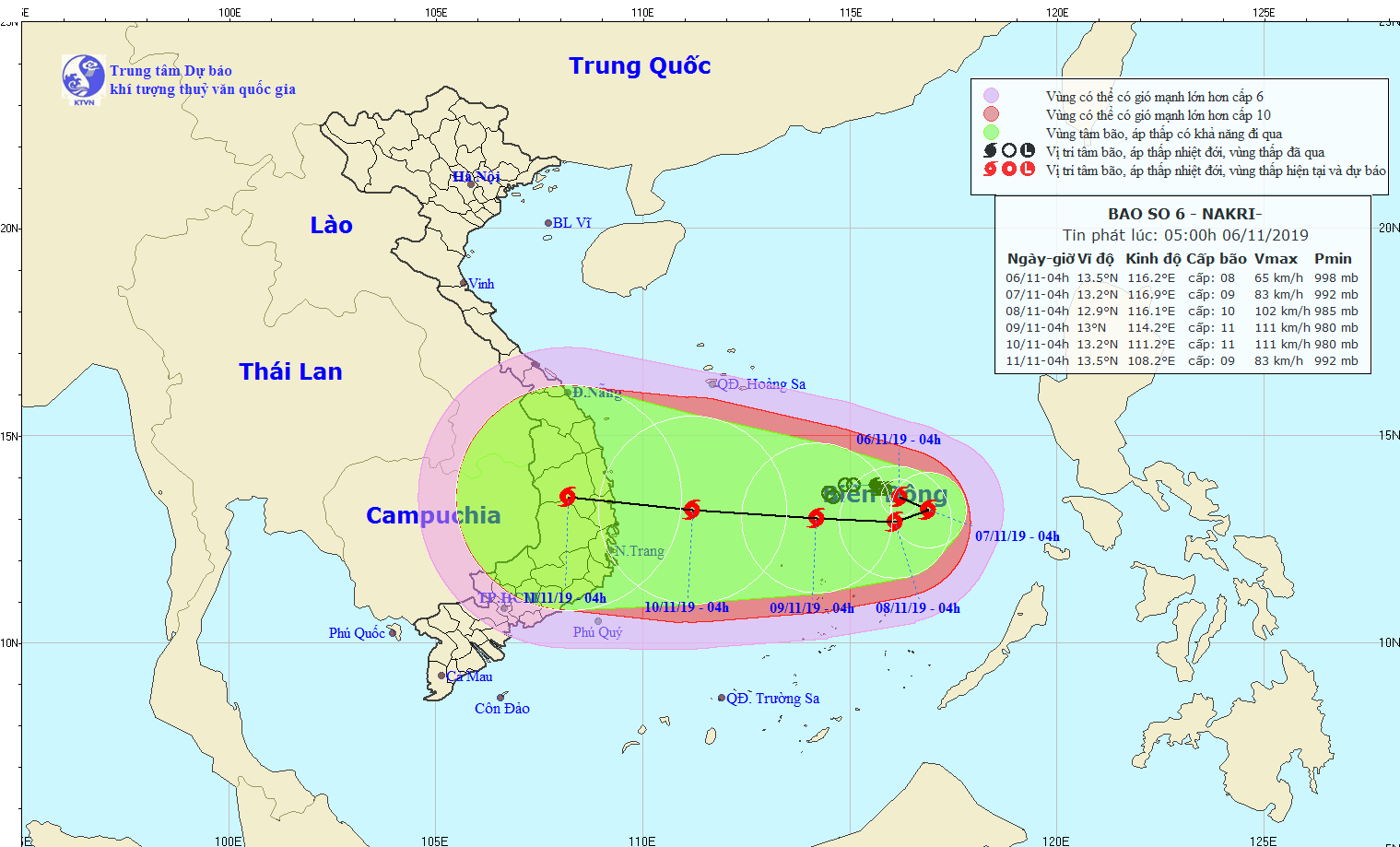
According to the National Hydrology Meteorology Forecast Center, Nakri is this year's sixth storm hitting the East Sea. At 4am today, the eye of the storm was located at around 310 kilometers from the Southwest Cay islet of the Spratly Islands.
The strongest winds near the center gusted between 60 and 75 kilometers an hour. Currently, the dangerous zone is moving slowly with its direction like direction of the tropical low pressure system reported yesterday.
By this morning of November 7, the tropical storm will slowly move southward and westward respectively with a maximum speed of 5 kilometers an hour.
In the next 24 hours, Nakri would be centered at around 280 kilometers from the Southwest Cay islet with its speed of up to 100 kilometers per hour.
In upcoming days, the tropical storm is expected to operate powerfully and head to the westward with the rapid speed.
Pursuant to a map of the National Hydrology Meteorology Forecast Center drawing the direction of Nakri, it will make landfall in the South- Central region as what happened last week by Matmo as well as Damrey in November, 2017.


