Additionally, the localities need to monitor, count the number of vessels working in areas affected by the tropical depression; regularly keep in touch with ship owners; closely control fishing vessels; give instructions for boats anchoring at the terminals and be ready for rescue teams and means amid the unexpected occurrence situations.
The Ministry of Natural Resources and Environment was assigned to closely monitor, forecast and promptly provide information on the development of the tropical depression; meanwhile, the Ministry of Foreign Affairs is in charge of contacting countries in the affected zone to create favorable conditions for Vietnam’s fishermen and fishing vessels to take shelter, rescue.
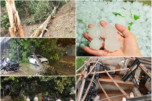
According to the National Center for Hydrology Meteorology Forecasting, a low tropical pressure system intensified into a tropical depression at midnight on June 28.
At 1 a.m. on June 29, the eye of the tropical depression was at around 16.2 degrees north latitude and 116.2 degrees east longitude, at around 500 kilometers far from the eastern Paracel Islands.
In the next 24- 48 hours, its path is forecast to toward the northwest at a speed of 5-10 kilometers an hour and continue to develop into a storm.